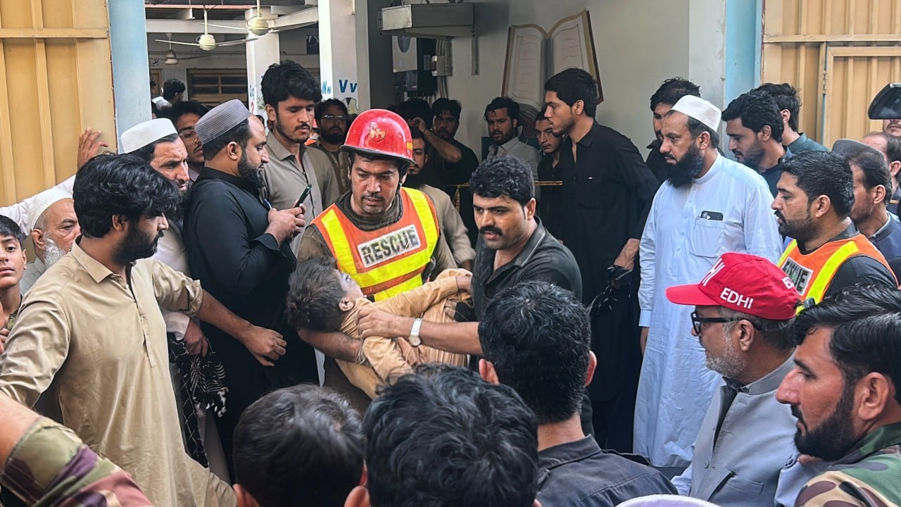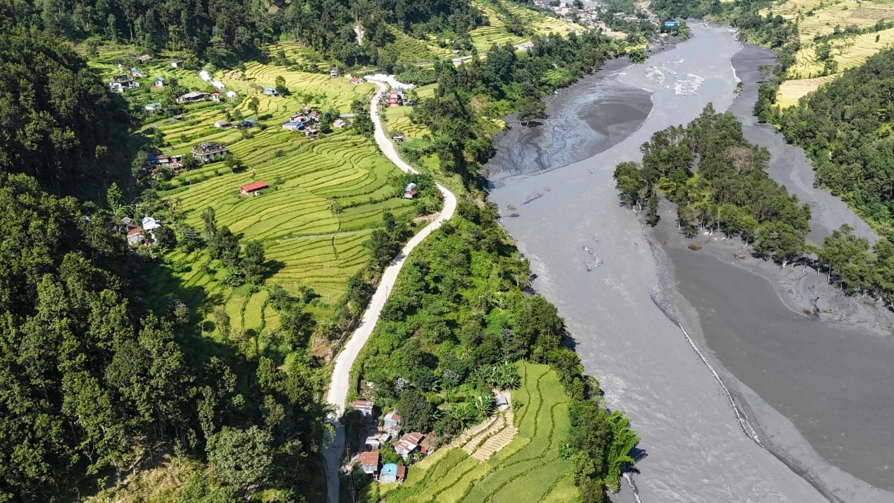
Nepal's recurring disasters involving avalanches, floods, and landslides are not independent weather events hitting a static landscape; they are coupled mass-wasting cascades operating inside an actively uplifting, warming mountain belt. Standard commentary often treats each event as a standalone tragedy driven by climate change or weak governance. That framing misses the operational physics that turn a high-altitude slope failure or intense rainfall pulse into a valley-wide catastrophe.
To understand why these cycles persist—and why conventional disaster management keeps getting caught off guard—we have to replace vague hazard lists with a mechanistic model. Below is a structural breakdown of how the system fails, what drives escalation, and where practical intervention actually works. Don't forget to check out our recent article on this related article.
Deconstructing the Competitor Narrative
Typical coverage of Nepal's multi-hazard cycle relies on a familiar chain of assumptions: global warming melts ice and increases extreme rain, steep terrain makes failure easy, under-resourced institutions struggle to respond, and victims bear the cost. While each statement points toward something real, treating them as a flat checklist obscures how the system behaves under stress.
The first analytical flaw is hazard isolation. Treating avalanches, glacial lake outburst floods (GLOFs), debris flows, and monsoon landslides as separate categories hides the fact that one event routinely manufactures the conditions for the next. A rock-ice detachment can dam a gorge or entrain loose channel sediment, converting a clear-water surge into a high-density slurry with far greater destructive reach. To read more about the history here, BBC News provides an in-depth breakdown.
The second flaw is monitoring bias toward cataloged lakes. Much of the institutional attention in the Himalaya has historically focused on mapped moraine-dammed lakes because their basins are visible and measurable over time. Yet catastrophic surges can originate from uncataloged steep ice-rock faces, permafrost thaw, temporary debris dams, or intense localized cloudbursts that bypass lake-centric early warning systems.
The third flaw is confusing exposure with hazard alone. A steep slope or glacial lake is a physical hazard, not a disaster by itself. Disaster scale depends on where high-value assets—hydropower intakes, cross-border highway corridors, bridges, and valley settlements—sit relative to narrow river gorges and sediment runout paths.
The Coupled Cascade Framework
A more accurate way to analyze Nepal's mountain hazards is a Four-Stage Cascade Model: Preconditioning, Triggering, Entrainment and Damming, and Corridor Amplification. Separating these stages clarifies where risk builds quietly and where catastrophic nonlinearity begins.
Stage 1: Preconditioning and Strength Loss
Mountain slopes and glacial margins lose stability long before a visible collapse occurs. In high-elevation Himalayan terrain, long-term warming thins glaciers, de-buttresses steep rock walls as ice retreats, and degrades permafrost in fractured bedrock. At the same time, monsoon cycles and prior mass movements leave thick blankets of unconsolidated moraine, colluvium, and alluvial sediment perched along steep valleys.
Known facts establish that high-mountain warming, glacier retreat, and slope instability interact across the region. What remains an educated hypothesis in many individual events—requiring site-specific geotechnical and glaciological attribution—is the exact threshold at which progressive permafrost thaw or snowmelt infiltration tips a specific rock-ice mass past its shear-strength limit.
Stage 2: Triggering Mechanisms
Once a slope or basin is preconditioned, a trigger initiates rapid movement. Common triggers include:
- Thermal and hydraulic weakening: Snowmelt, rain-on-snow events, or subsurface water pressure reducing friction along rock fractures and basal shear zones.
- Hydro-meteorological extremes: Intense, localized monsoon downpours or cloudbursts that rapidly saturate shallow soils and exceed channel capacity.
- Cryospheric and geological shocks: Ice-rock detachments, moraine or ice-dam breaches, or seismic shaking that destabilize over-steepened masses.
Stage 3: Entrainment, Bulking, and Transient Damming
This is the stage most narrative accounts gloss over, yet it often governs downstream lethality. As ice, snow, rock, and water plunge down steep gradients, friction generates meltwater while the moving mass scours loose debris from gullies and riverbeds.
The physical consequence is sediment bulking. A flow that starts as a rock-ice avalanche or modest water release can pick up massive volumes of rock and mud, transforming into a dense debris flow or hyperconcentrated slurry. Higher density increases impact forces on bridge piers, retaining walls, and intake structures far beyond what clear-water hydraulic assumptions predict.
In parallel, landslide or avalanche debris can choke a narrow gorge to form a landslide-dammed or debris-dammed lake. Unlike large, well-studied glacial lakes, temporary debris dams can impound water rapidly and breach within hours or days without prior warning, sending a secondary surge downstream.
Stage 4: Corridor Amplification
Nepal's topography funnels mountain runoff and debris through constrained river valleys that also serve as arteries for transport, trade, and power generation. When a surge enters a narrow canyon, flow depth spikes, bank erosion undercuts adjacent slopes, and road benches or riverside settlements sit directly in the path of high-velocity sediment transport.
If a flood damages gauges, washes out roads, or severs communications early in the event, downstream communities and emergency teams lose real-time situational awareness just as the wave propagates. The physical hazard thus turns into a compounding operational crisis.
Why Standard Metrics and Monitoring Fall Short
Evaluating mountain risk by counting total annual disasters or tracking only a fixed list of high-profile glacial lakes creates a false sense of visibility. Three structural blind spots explain why surprises keep happening.
The first blind spot is sparse sensor density in complex terrain. Automated weather stations, stream gauges, and slope-monitoring instruments across Himalayan watersheds are far sparser per unit area than in intensively instrumented alpine systems like Switzerland. Steep relief and localized microclimates mean critical rainfall or ground movement can occur between stations—or wipe out sensors located near the channel bed before alerts propagate.
The second blind spot is treating past events as isolated anomalies rather than state changes. When a major flood or debris flow moves through a valley, it deposits fresh, unstable sediment along the channel and scars adjacent slopes. That newly deposited material becomes fuel for subsequent surges during the next heavy rain or upstream release.
The third blind spot is siloed infrastructure planning. Hydropower developers, road builders, and municipal planners often evaluate site viability using historical station records or single-hazard checklists. In a non-stationary mountain environment with rapid sediment transport and cascading failures, historical baselines understate tail risk, and project-by-project approvals rarely account for cumulative corridor exposure.
Operationalizing Resilience: A Tactical Playbook
Fixing a coupled hazard system requires shifting from reactive relief and single-hazard checklists to cascade-aware risk management. Practitioners and policymakers can execute this shift in four sequential steps.
- Map cascade corridors rather than isolated hazards. Overlay steep ice-rock detachment zones, permafrost-degrading slopes, glacial lakes, and legacy debris deposits onto shared river-corridor models. Identify pinch points where debris damming or sediment bulking can amplify flows.
- Tier monitoring and early warning by runout time and vulnerability. Reserve expensive, continuous instrumentation for high-consequence corridors where settlements, border crossings, or critical power assets sit downstream of rapid-onset hazards. Pair satellite change detection with automated hydrological and seismic/infrasound triggers placed high enough or redundantly enough to survive initial surge fronts.
- Enforce corridor-level infrastructure and land-use rules. Require cumulative hazard and sediment-transport assessments for roads, bridges, and hydropower intakes along shared river basins. Restrict permanent construction in high-frequency runout and bank-undercutting zones, and design river crossings and intakes to tolerate debris loads rather than clear water alone.
- Institutionalize cross-border data and alert protocols. Because Himalayan river systems and cryospheric hazards cross national boundaries, late or fragmented information on upstream glacier collapses, lake breaches, or heavy rain narrows evacuation windows downstream. Standardized, rapid data sharing across border basins is an operational necessity, not a diplomatic nicety.
Limitations and Failure Modes to Expect
Even a well-engineered strategy runs into hard physical and fiscal constraints. High-altitude terrain, extreme weather, and difficult access make dense ground sensor networks and heavy structural engineering expensive to install and maintain. Physical interventions on every unstable slope or growing glacial lake are economically and logistically unfeasible.
Furthermore, no early warning system can eliminate risk from ultra-fast rock-ice avalanches or cloudbursts when travel times in steep gorges are measured in minutes rather than days. Over-relying on technical forecasting while leaving critical assets exposed in known hazard paths creates brittle systems. Physical exposure reduction and warning must work together, with realistic expectations about irreducible uncertainty.
Strategic Recommendation for Corridor Operators and Planners
Stop treating Nepal's avalanche, flood, and landslide emergencies as disconnected seasonal shocks, and re-baseline asset siting, insurance, and emergency response around multi-stage sediment and water cascades along high-value river corridors. Any organization building, financing, or governing infrastructure in these valleys should audit its exposure to upstream slope-to-channel couplings and post-event sediment remobilization before committing new capital—because in steep Himalayan corridors, the greatest risk often lies in how yesterday's instability primes tomorrow's surge.