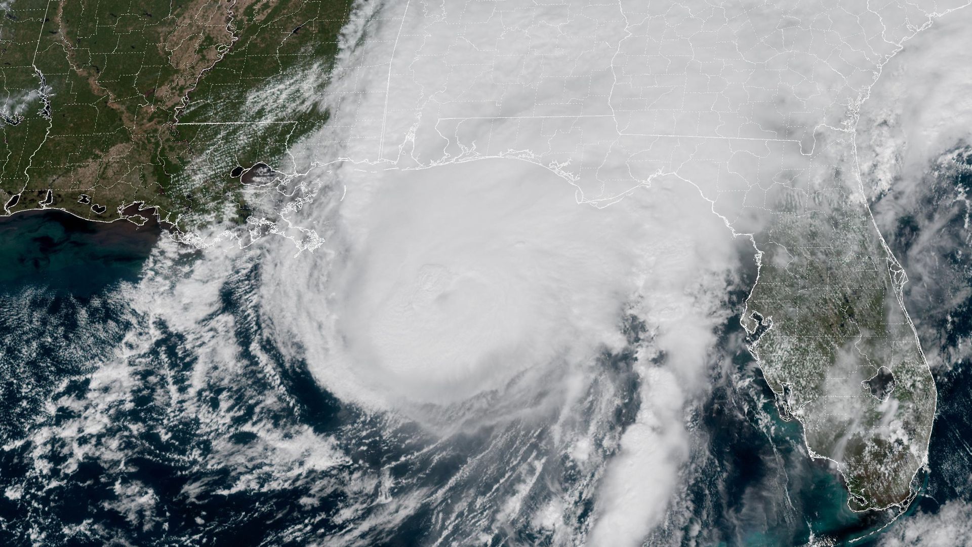
Predicting tropical cyclone trajectories involves evaluating steering currents, thermodynamic efficiency, and oceanic heat content within a chaotic fluid dynamic environment. When an atmospheric disturbance like Hurricane Isaias approaches a coastline, standard meteorological reporting often relies on qualitative descriptions of storm intensity and imminent impact. A rigorous analytical breakdown requires shifting from descriptive tracking to structural forecasting, examining the precise variables that govern storm intensification, landfall placement, and regional vulnerability.
The Atmospheric Steering Matrix
Tropical cyclones do not possess internal propulsion; their movement is dictated entirely by the surrounding environmental wind fields, primarily through deep-layer mean steering flow. To understand why a system tracks toward a specific coastal sector, one must analyze the interaction between the subtropical ridge, known colloquially as the Bermuda High, and mid-latitude troughs traversing the continent.
When the subtropical ridge extends westward across the Atlantic and into the southern tier of the United States, it establishes a persistent easterly to southeasterly flow that forces a westward or northwestward translation vector. The translational speed of the system is inversely proportional to the amplitude of the ridge and directly proportional to the pressure gradient force established between the high-pressure center and the cyclonic vortex.
[Subtropical Ridge Position] ---> [Steering Flow Vector] ---> [Vortex Translation Track]
                                         ^
                                         |
[Mid-Latitude Trough Amplitude] ---------+
When a mid-latitude trough dips southward into the eastern United States, it erodes the western periphery of the ridge. This structural weakness in the pressure field creates a steering channel, often referred to as a weakness or break in the ridge. As Isaias approached the operational domain of the Gulf Coast and the southeastern seaboard, the primary variable governing its trajectory was the rate of progression and amplification of this northern trough. A faster-moving trough induces recurvature, pulling the cyclone away from land or accelerating it northeastward. A slower or shallower trough leaves the ridge intact, maintaining a westward trajectory into the Gulf of Mexico basin.
Thermodynamic Efficiency and Intensity Limits
The energetic capacity of a tropical cyclone is bound by the Carnot heat engine model adapted for atmospheric fluid dynamics, famously formalized by Kerry Emanuel as the Potential Intensity theory. The maximum potential intensity of a system is a function of the sea surface temperature, the outflow temperature at the tropopause, and the air-sea enthalpy disequilibrium.
Oceanic heat content within the Gulf of Mexico provides a massive reservoir of latent energy. However, surface temperature alone is insufficient for intensification; the depth of the warm water layer is the critical limiting factor. Shallow warm-core eddies or regions underlain by cooler water layers are susceptible to upper-ocean cooling induced by storm-driven vertical mixing. As high winds churn the upper ocean, cooler water from the thermocline is upwelled to the surface, cutting off the latent heat flux required to maintain or increase wind speeds.
+---------------------------+-----------------------------------+
| Environmental Factor      | Physical Mechanism                |
+---------------------------+-----------------------------------+
| Sea Surface Temperature   | Drives enthalpy disequilibrium    |
| Upper-Ocean Heat Content  | Prevents upwelling-induced cooling|
| Vertical Wind Shear       | Tilts vortex axis, vents energy   |
| Environmental Moisture    | Limits dry air entrainment        |
+---------------------------+-----------------------------------+
Vertical wind shear acts as the primary mechanical disruptor of this thermodynamic engine. Shear is defined as the vector difference between low-level winds and upper-level winds. When vertical wind shear exceeds approximately 10 to 15 meters per second, it tilts the vortex axis of the cyclone. This tilt displaces the warm core aloft from the surface low-pressure center, causing convective updrafts to be blown downshear. The system becomes asymmetric, moisture is vented away from the core, and entrainment of dry mid-tropospheric air suppresses eyewall convection.
Vulnerability Modeling and Coastal Infrastructure Bottlenecks
Evaluating the impact of a landfalling system requires moving beyond wind speed categories on the Saffir-Simpson scale, which accounts solely for peak sustained winds and fails to capture storm surge volume, rainfall distribution, or spatial footprint.
Storm surge is driven primarily by surface wind stress pushing water toward the coast, compounded by the inverse barometer effect where low atmospheric pressure allows the sea level to rise locally. The bathymetry of the continental shelf plays a decisive role in surge amplification. A gently sloping, broad continental shelf, characteristic of much of the Gulf Coast, acts as a hydraulic wedge, forcing a larger volume of water ashore compared to a steep bathymetric drop-off.
Infrastructure resilience during such events is dictated by network redundancy and drainage capacity. Urban drainage systems operate under gravity-fed discharge models. When a storm surge elevates coastal tailwater levels above outfall elevations, gravity drainage ceases, causing urban flooding even before peak rainfall rates are achieved.
[Atmospheric Pressure Drop] + [Wind Stress Vector] + [Shallow Bathymetry]
                                        |
                                        v
                            [Maximized Storm Surge]
                                        |
                                        v
                            [Outfall Submergence]
                                        |
                                        v
                            [Catastrophic Urban Flooding]
Critical facilities, including regional distribution nodes, electrical substations, and emergency response staging areas, frequently share common elevation thresholds and transport corridors. When a single meteorological event exceeds the design flood return period of these interconnected nodes, cascading failures propagate through the regional supply chain.
Strategic Operational Recommendations
To optimize resource allocation and structural hardening against future high-impact meteorological events, logistics and emergency management teams must transition from reactive deployment to continuous risk modeling.
- Decouple Response Triggers from Wind Categories: Establish operational thresholds based on integrated kinetic energy and forecast surge inundation maps rather than maximum sustained wind speed alone.
- Hardening of Tailwater Infrastructure: Retrofit coastal drainage outfalls with automated backflow prevention valves and auxiliary pumping capacity to maintain discharge capability during elevated sea-level conditions.
- Redundant Power Staging: Position mobile generation assets outside the projected 48-hour impact cone along elevated inland transport corridors, ensuring immediate post-event restoration of critical telemetry and pumping stations.