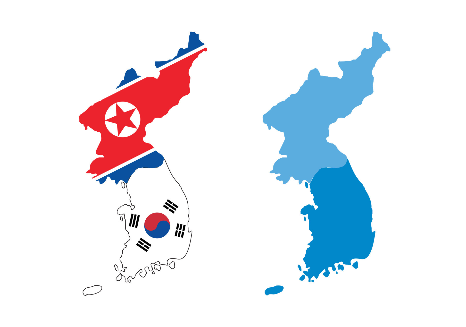
Honestly, if you look at a korea map north and south from space at night, it tells you everything you need to know without reading a single history book. South Korea is this blazing, neon-lit hub of electricity, and North Korea is basically a black hole, except for a tiny pinprick of light where Pyongyang sits. It’s wild. Two countries, one peninsula, and a border so intense that even the birds probably think twice before crossing it.
But lately, that map is changing in ways that don't just involve moving a line. We're talking about a complete shift in how these two "hostile states" view their own geography. Discover more on a related subject: this related article.
The Line That Isn't Actually a Line
Most people think the border is the 38th Parallel. You've probably heard that term a thousand times in history class. But here is the thing: the 38th Parallel hasn't been the actual border since 1950.
The real "line" is the Military Demarcation Line (MDL). It's a jagged, 155-mile-long (roughly 248 km) scar that cuts across the peninsula at an angle. It was drawn exactly where the soldiers were standing when the fighting stopped in 1953. Because the South Korean forces pushed harder on the eastern side, the map actually slants upward toward the east. This means South Korea ended up with a bit more land in the mountains, while North Korea kept more of the western plains. More analysis by The Washington Post explores comparable perspectives on this issue.
The Buffer Zone: No Man's Land
Surrounding that MDL is the Demilitarized Zone (DMZ). It’s a 4-kilometer-wide buffer strip—2km on each side. It’s the most heavily fortified "peace" zone on the planet.
- Lush Wilderness: Because humans haven't stepped foot in most of it for 70 years, it's basically a nature preserve. We’re talking about endangered Siberian tigers (maybe!) and Amur leopards roaming through minefields.
- The Tunnels: Underneath the map you see on paper, there's a 3D reality. South Korea has discovered four massive "aggression tunnels" dug by the North, designed to move thousands of troops under the border in an hour.
- The Propaganda Villages: In the JSA (Joint Security Area), you’ve got two villages facing each other. Daeseong-dong in the South and Kijong-dong in the North. Kijong-dong has one of the tallest flagpoles in the world—160 meters high—just to prove a point.
Why the Map Looked Different in 2024 and 2025
If you haven't checked the news lately, Kim Jong Un basically grabbed a metaphorical eraser and started rubbing out the "unification" parts of the korea map north and south.
In a massive constitutional shift in 2024, North Korea officially labeled the South as their "primary foe." They didn't just stop at words. In October 2024, they literally blew up the Gyeongui and Donghae rail and road links. These were the physical symbols of a future where you could take a train from Seoul to London. Now? They’re just piles of rubble and tactical trenches.
As of early 2026, the North has been seen fortifying these areas with even more mines and concrete barriers. They aren't just protecting a border anymore; they are trying to erase the very idea that the two sides were ever the same country.
The Geography of Two Worlds
The physical land itself is pretty different once you cross that line.
North Korea is a sea of mountains. About 80% of the country is uplands. It’s rugged, it’s cold, and it’s tough to farm. This is why their population (about 26 million) is so concentrated in the small western plains around Pyongyang.
South Korea is also mountainous, but it has broader coastal plains and a much warmer climate. In fact, due to climate change, farmers in the southern parts of the ROK are now growing bananas and papayas—crops that would have been impossible a few decades ago.
Quick Stats at a Glance
| Feature | North Korea (DPRK) | South Korea (ROK) |
|---|---|---|
| Land Area | ~120,540 sq km | ~100,363 sq km |
| Highest Point | Paektu Mountain (2,743m) | Hallasan (1,947m) |
| Population | ~26 million | ~51.7 million |
| Capital | Pyongyang | Seoul |
The Sea Border: The Northern Limit Line (NLL)
While the land border is quiet (mostly), the sea map is where things get messy. There’s something called the Northern Limit Line.
It’s an unofficial maritime border in the Yellow Sea. North Korea has never really accepted it. Because the line hugs the North Korean coast to keep five specific islands in South Korean hands, Pyongyang often claims their territorial waters extend much further south. This is where most of the actual "shooting" incidents have happened over the last 20 years. If you’re looking at a korea map north and south to understand risk, look at the west coast.
Navigating the Map Today
You can't just drive across. There is zero civilian traffic. If you want to go from Seoul to Pyongyang, you generally have to fly to Beijing, China, and then take a separate flight or train in.
However, the South is trying to change the "vibe" of their side of the map. The Ministry of Unification recently proposed turning more of the border area into "Peace Trails." They want people to hike right up to the wire to see the history. It’s a weird mix of tension and tourism.
Honestly, the map isn't just about geography anymore—it's about identity. While the South still holds onto the dream of a unified peninsula (at least in their constitution), the North is moving toward a "two-state" reality where that line in the sand is a permanent wall.
What You Can Do Next
If you're fascinated by the layout of the peninsula and want to see the reality of the korea map north and south for yourself, here is how to dive deeper:
- Check out the DMZ Peace Trail: If you are in South Korea, you can apply through the DMZ Peace Trail portal for guided treks along the border. It's a surreal way to see the "sanctuary" that has formed between the fences.
- Use Satellite Imagery: Hop on Google Earth or Sentinel Hub. Look at the "Night Lights" layer. Comparing the luminosity of Seoul vs. Pyongyang is the most visceral way to understand the economic gap.
- Watch the JSA: Keep an eye on the Joint Security Area news. Any movement of the blue tables or the soldiers there is usually the first sign of whether the "map" is heating up or cooling down for the year.