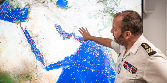
Imagine standing on the bridge of a 150,000-ton oil tanker. You're trying to squeeze through a 33-kilometer-wide choke point, but your screens show you're cruising at 90 knots over an airport runway in Iran. You aren't flying, and you haven't run aground. You're just a casualty of the massive electronic warfare storm sweeping through the Middle East.
The recent crisis in the Strait of Hormuz has turned the Persian Gulf into a terrifying live test for global maritime positioning infrastructure. This isn't just about localized military skirmishes. It's an existential threat to how goods move across the planet. If you think a supply chain crisis is bad, try managing one where the ships don't even know where they are.
The truth is that the era of reliable, uncontested civilian satellite navigation is officially dead in conflict-adjacent waters.
The Broken Compass of the Persian Gulf
Most people assume a massive container ship or supertanker features sophisticated, militarized navigation hardware. It doesn't. The electronic systems on a billion-dollar cargo ship are often more vulnerable than the smartphone in your pocket.
When the conflict escalated in early 2026, the electronic environment degraded instantly. In the first few weeks alone, the Joint Maritime Information Centre (JMIC) logged periods where more than 1,650 ships simultaneously suffered from Global Navigation Satellite System (GNSS) interference.
We need to understand how this tech works to see why it fails so spectacularly. GNSS signals—whether they're American GPS, European Galileo, or Russian GLONASS—travel from satellites orbiting 20,200 kilometers above the earth. By the time those radio waves reach a ship's antenna, they're incredibly weak, usually hovering around -130 dBm.
State actors don't need high-end military tech to mess with this. A relatively simple, ground-based transmitter can easily flood the area with stronger radio noise on the same frequencies. That's raw jamming. It simply blinds the receiver, triggering alarms on the bridge and cutting off position data.
Worse than jamming is spoofing. Instead of blocking the signal, spoofing transmits a fake, slightly stronger signal that mimics real satellite data. The ship's onboard systems blindly accept the fake coordinates. This forces the vessel’s Automatic Identification System (AIS) to broadcast absurd data to the rest of the world, creating digital ghost fleets that appear to be clustered in perfect geometric circles miles away from their actual locations.
Why Shifting to a Permission-Based Corridor Changes Everything
The electronic chaos hasn't been accidental collateral damage. It's been weaponized to fundamentally reshape maritime geography. Iran’s Islamic Revolutionary Guard Corps (IRGC) has actively twisted this digital blindness to shift the Strait of Hormuz from an open international transit lane to a strictly controlled, permission-based corridor.
During the peak of the electronic warfare onslaught, commercial traffic through the strait cratered to near-zero levels. War-risk insurers like Gard and Skuld pulled coverage. Shipping giants like Maersk and CMA CGM halted transits or chose expensive, long-haul rerouting around Africa.
But when the jamming sporadically moderates, it isn't out of goodwill. It’s selective enforcement. The IRGC has used the resulting chaos to force a strict vetting process. Ships from favored nations, or those willing to pay a rumored $2 million toll in alternative currencies, are given clear windows to pass.
Meanwhile, unauthorized vessels, or those linked to Western nations, find themselves blinded by localized electronic warfare systems the moment they approach the choke point. In late March, two Hong Kong-flagged container ships were forced to turn back into the Gulf after their navigation systems were scrambled, showing just how tightly this digital fence is managed.
The Cascading Failures of Blind Bridges
You might think a seasoned captain could just look out the window and steer the ship. In a tight, congested waterway like the Strait of Hormuz, that’s a fantasy.
Modern commercial vessels rely heavily on integrated bridges. The GPS signal doesn't just put a dot on a digital map. It feeds into:
- The radar systems to calculate collision risks.
- The Electronic Chart Display and Information Systems (ECDIS) to map underwater hazards.
- The ship’s internal master clocks that synchronize automated machinery.
- The AIS transponders that tell nearby vessels who you are and where you're heading.
When you inject corrupt position data into this ecosystem, the entire bridge fails. Radars throw errors. Collision-avoidance alarms scream continuously. Autopilots try to turn the ship sharply to "correct" a fictional course deviation.
I've talked to maritime systems engineers who note that the psychological toll on crews is immense. Navigating a narrow channel at night while every screen on your bridge is lying to you creates severe cognitive overload. One wrong move doesn't just mean running aground; in a militarized zone, it means accidentally drifting into hostile territorial waters and facing immediate seizure.
Surviving the New Era of Electronic Warfare
The maritime industry has treated satellite positioning as a free, permanent utility for thirty years. That naive assumption is gone. If you operate ships, manage maritime logistics, or oversee supply chain security, you can't wait for international diplomacy to fix this.
Here are the immediate, practical steps ship operators are taking to adapt to this hostile electronic landscape:
1. Reverting to Terrestrial and Inertial Backups
Navigators are dusting off old-school skills and upgrading hardware. High-end commercial vessels are installing independent Inertial Navigation Systems (INS). These systems use gyroscopes and accelerometers to calculate a ship's position relative to a known starting point without needing an external satellite link. While they suffer from "drift" over long periods, they're completely immune to radio frequency jamming.
2. Upgrading to Multi-Constellation, Authenticated Receivers
Relying solely on standard civilian GPS frequencies is a liability. Modern receivers must utilize multiple constellations simultaneously, including Europe's Galileo and China’s BeiDou. Crucially, operators are upgrading hardware to leverage Galileo's Open Service Navigation Message Authentication (OSNMA). This tech uses cryptographic signatures to verify that the satellite signal is genuine, protecting the bridge from deceptive spoofing attacks.
3. Deploying Optical and Radar Pilotage Asset Kits
In choke points like Hormuz, visual and radar navigation must take precedence over digital maps. Crews are being retrained in traditional parallel indexing on radars, using stable landmasses and fixed geographic features rather than satellite coordinates to verify their position.
The maritime domain has officially entered a period where the electromagnetic spectrum is just as contested as the physical water. Companies that invest in resilient, multi-source position architectures will keep their cargo moving. Those that continue to rely on fragile, unauthenticated satellite signals will find themselves stranded, blinded, and locked out of the world's most critical trade routes.
Navigating through GPS Jamming
This video details the direct economic fallout and operational realities faced by commercial vessels attempting to traverse the highly volatile, jammed corridors of the Middle East.